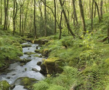
Living England Habitat Map
Natural England’s Living England project is transforming monitoring habitat distribution and environmental change across England.
By integrating field surveys, Earth observation (EO) data, and AI modelling, Living England provides a national, openly accessible habitat map that supports evidence based decision making across government, conservation bodies, and industry.
Issue
Globally the decline in biodiversity has been driven by environmental pressures including climate change, land use and habitat degradation.
Decision makers across planning, conservation, land management, and policy need reliable information to measure environmental baselines, track change, and evaluate the success of nature recovery interventions.
In England, a national, standardised, and frequently updated mapping approach has been developed as an evidence base for users in government, industry and communities.
Approach
The Living England project uses a combined field‑survey, Earth Observation, and machine‑learning approach to create a nationwide, open‑access habitat map for England.
It integrates more than 80,000 ground‑surveyed habitat records with over 350 layers of satellite, LiDAR, and geospatial data, segmented into 13 million polygons and classified using a distributed random‑forest model to map 16 habitat types with an overall accuracy of 87%.
Impact
Living England provides the first nationally consistent and openly accessible habitat map of England, offering coverage of 16 broad habitat types.
The project is an open data product, with published methodology and standards. This data is published with accuracy values which allows users to understand what confidence they can have in the data, and the analysis undertaken.
The dataset provides evidence for major environmental initiatives, including Defra’s 25 Year Environment Plan, Local Nature Recovery Strategies, State of Natural Capital reporting, Ordnance Survey’s enhanced land‑cover products, and Biodiversity Net Gain assessments.
The underlying data and the visualisation is widely used across government, conservation bodies, utilities, environmental consultancies, and academia. It supports identifying priority areas for nature recovery, assessing habitat extent and condition, evaluating the impact of management interventions, and informing land‑use planning at both local and national levels.
More information
- Organisation: Natural England
- Explore the map