Ordnance Survey
Ordnance Survey supports the Society's core charitable activities that raise the profile and awareness of geospatial intelligence, advancing geographical understanding and using geospatial interpretation and location insight for positive impact.
Learn more about our partnership.
Ordnance Survey is Great Britain’s national mapping agency. It provides up to date and definitive mapping data to government, businesses, and consumers, as well as location based insights, expertise and geospatial intelligence services.
As a global geospatial leader, Ordnance Survey plays an important role in the development of geospatial standards and unlocking the benefit of geospatial data both in the UK and internationally. OS is committed to supporting geography related research and education at all levels.
The Society and Ordnance Survey share a substantial common interest in geography, especially in advancing geospatial understanding and using geospatial interpretation and location insight for positive impact.
Building on our long-standing relationship Ordnance Survey support our work to advance geospatial understanding. We will:
- Showcase professional applications to selected pressing issues;
- Enable policy and engagement activities between OS and the Society;
- Engage professional communities of practice in the UK;
- Enhance the education foundation;
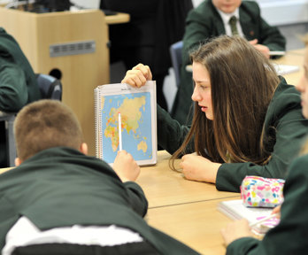
- Engage and inspire students and teachers in schools;
- Showcase career opportunities;
- Provide OS staff engagement opportunities;
- Profile the partnership between the OS and the Society.
Ordnance Survey Awards
In recognition of excellence in geography education at the secondary level.
Teachers Fiona Sheriff and Cyrus Golding on receiving the Ordnance Survey Award 2024
In recognition of excellence in geography education at secondary level
Young Geographer of the Year
A national competition run by the Society to encourage pupils to engage with geographical issues.
Geovisualisation
Discover how geographers bring a unique perspective to presenting data in innovative and understandable ways.
Resources for schools
Browse our catalogue of award-winning resources to enhance geographical learning.