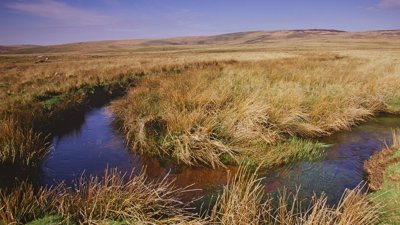
The England Peat Map (EPM) provides baseline evidence on the extent, depth and condition of England’s peatlands. The map layers were created using machine and deep learning modelling techniques, trained with pre-existing survey data as well as new survey data commissioned by EPM.
Predictor data used in the modelling process included national-scale satellite imagery, topographic LiDAR, geological and historic land-use data.
This webinar will provide an overview of the EPM project, covering the data and methods used as well as the outputs produced and where to find them.
About the speakers
Sam Dixon is a senior data scientist within the EPM team in Natural England. Having previously worked at Moors for the Future Partnership, Sam has over 8 years of experience in handling and analysing peatland geospatial data. He currently leads on the incorporation of the peat map into the UK’s greenhouse gas inventory.
Oliver Gutteridge is a higher data scientist within the EPM team at Natural England. Oliver developed much of the code to model peatland extent and depth and previously led on data management within the project.
- Webinar

How do natural hazards become disasters?
Join this webinar with the Disaster Risk Management Professional Practice Group to explore how and why natural hazards become disasters, and how hazard scenarios can help support disaster risk reduction.
OnlineProfessionalsWednesday 1 July 2026 - Webinar

Understanding and communicating risk through geospatial applications
Hear from the Royal National Lifeboat Institution (RNLI) geospatial team on the range of tools developed to support risk assessment and decision-making across the organisation.
OnlineProfessionalsThursday 2 July 2026 - Discussion
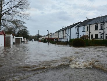
Forecasting surface water flooding in climate cange
This online panel, hosted by the RGS-IBG Climate Change Research Group, will hear from experts dicussing surface water flooding in a changing climate.
OnlineProfessionalsThursday 2 July 2026