
The Geospatial intelligence for crisis response symposium brought together researchers, practitioners, and innovators from across the fields of geography, disaster management, and search and rescue operations.
In a world characterised by complex risks, evolving hazards, and spatial inequalities, understanding the geographical dimensions of crisis has become a critical priority. This conference explored how geospatial thinking and technologies are shaping contemporary responses to emergencies.
Dr Alun Newsome, ReSearchers Ltd
Dr Craig Colley, University of Portsmouth
Dr Geoff Newiss, University of Portsmouth
Dr Ian Greatbatch, University of Portsmouth and Aston University
Harry Machette-Downes, MapAction
Pete Masters, Humanitarian OpenStreetMap Team
- Webinar
Disaster risk: event monitoring and post damage assessment
In this session, speakers discuss the role of geography in mobilising event response and logistics, real-time monitoring and communication to damage assessment, civil recovery and implementation of lessons learned.
OnlineProfessionalsWednesday 29 July 2026 - Webinar

Professional Pathway introductory webinar – August
Join this webinar to learn more about the Professional Pathway. We will discuss the programme’s framework, highlight key professional development activities and guide you through the application process.
OnlineProfessionalsWednesday 5 August 2026 - Webinar
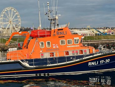
Understanding and communicating risk through geospatial applications
Hear from the Royal National Lifeboat Institution (RNLI) geospatial team on the range of tools developed to support risk assessment and decision-making across the organisation.
OnlineProfessionalsWednesday 9 September 2026