Use the Flooding PowerPoint presentation (see downloadable resources) in conjunction with the Lesson Plan. The PowerPoint presentation follows the sequence of the lesson and contains the photographs and images that illustrate the main teaching points. The Flooding Factsheet (see downloadable resources) accompanies this lesson explains some of the main points in more detail.
Key Objectives
To understand the factors that cause rivers to flood.
To understand what happens to the physical environment when flooding occurs.
To understand the human impact of a major flood event.
To understand how to prepare for flooding.
Web Links
-
To look up whether your area, or another place, is liable to flooding go to the Environment Agency website
-
For detailed guidance on flooding go to the Environment Agency website
-
For information on how to prepare your property for flooding go to the UK Government website
Starter
The whole class takes part in the Follow-Me Loop Card activity (see downloadable resources) based on the teaching and learning from the previous lesson, Journey of a River. This activity is provided, but will need to be cut up in advance of the lesson.
Instructions:
-
There are seventeen cards in this pack- enough for one between two.
-
Each card contains one answer (typed in black) and one question (typed in blue).
-
The teacher also has a card and starts the game by reading out the first question from it.
-
Only one card contains the correct answer, which the pupil holding it will read aloud to the class.
-
Having read the correct answer, the pupil continues the loop by reading their accompanying question.
-
The loop activity will always finish with the teacher, who has the final answer.
Additional questions and answers can be added by the class teacher as needed.
This game should be fast paced.
Main Activity
Flooding: The Physical Process
Reiterate that rivers can be divided into stages; the upper course, middle course and lower course.
Give pupils a scenario: It’s raining in the upper course.
What happens to the precipitation? Show pupils the diagram on the Flooding PowerPoint presentation to illustrate the scenario.
The ensuing discussion should elicit the following responses:
-
The water evaporates
-
The water is taken up by trees and plants
-
The water infiltrates the soil
-
Surface runoff flows into tributaries
What happens if:
The rainfall is very heavy (a large amount of precipitation in a short amount of time) or if the rainfall is prolonged (precipitation over several days, weeks or months)?
-
The ground will become saturated and unable to absorb any more water
-
There will be increased surface runoff into tributaries
-
Tributaries will, consequently, contain a greater volume of water
-
This water will eventually feed into the main river channel in the middle course
Lag time:
Although the rainfall may have stopped, the water level in the river will continue to rise. This is because it takes time for the water to flow from the tributaries in the upper course to the main river in the middle course. The water in the river can continue to rise for many days. The river reaches bankfull when the water level rises to the top, but does not spill over, the river bank.
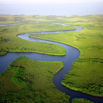
What will happen if water continues to flow into a river that is bankfull? This may happen if it starts to rain again, and surface runoff and throughflow continue. In a process called overbank flow, the water will ‘spill over’ the top of the river bank. This water will then flood the surrounding land. This land is called the flood plain. So, flooding occurs when the discharge of a river is too great for its channel to hold; the water will simply flow over the top of river bank and cause flooding.
This is a particular problem in the middle course of a river because the land is relatively flat and the water can spread long distances- just like a spilt drink across a table.
Show pupils the diagrams on the PowerPoint to illustrate the stages of flooding.
Building on a Floodplain:
Flooding changes the landscape- sometimes temporarily, sometimes permanently. However, flooding can also affect people and communities. Historically, houses were located on flood plains because of their rich, fertile soils which were good for agriculture. Living close to navigable rivers also helped trade and commerce and the economic development of villages and towns. Today, houses are built on flood plains because of a shortage of affordable land for homes. Additionally, a riverside location can be sought after because it affords a householder picturesque views. In this instance houses close to rivers can be priced at a premium.
Flooding Case Studies
Pupils may have personal experience of flooding. Discuss pupils’ own experiences before highlighting the case studies.
-
Tewkesbury in Gloucestershire 2007
Thirteen people died as a result of the floods that hit Tewkesbury in July 2007- some of the worst flooding ever recorded in Britain. Following a very dry April, double the average rain fell between May and July. On 20th July 2007, 140 mm of rain fell in just 14 hours (equivalent to two months’ worth of rain). Tewkesbury was completely cut off- surrounded entirely by flood water.
Tewkesbury is particularly vulnerable to flooding because of its geographical location at the confluence of two rivers: the Severn and the Avon. Neither river was able to cope with this volume of water. As the additional water fed down into the river system, the rivers met at Tewkesbury: a major flood event was inevitable.
In Tewkesbury alone, 1800 homes were flooded.
Across the Gloucestershire region as a whole, nearly 50,000 homes were affected, losing electricity for two days, and mains water supplies for up to 17 days. Other homes needed significant repairs. Many people had to be evacuated from their homes by helicopter and boat and were given temporary shelter.
Show pupils the maps and photographs of Tewkesbury as this information is discussed. You might also like to use Google Earth to locate Tewkesbury and the confluence of the River Severn and River Avon.
-
Somerset Levels 2014
During the flooding of 2014 the worst affected areas were Somerset, Devon, Dorset and Cornwall in the south west and the Thames Valley in the south east. Prolonged rain and hurricane force winds resulted in the wettest December and January since 1876.
Alongside heavy rainfall that resulted in river flooding, tidal surges also affected coastal areas. In the UK as a whole, almost 8,000 homes were flooded. In Somerset, farmland was also submerged under water for several months costing farmers upwards of £100million, when the River Parrett burst its banks.
Two Somerset villages, Muchelney and Burrowbridge made headlines because they were effectively cut off from the surrounding area- accessible by boat and later by specially erected pontoons.
The village of Muchelney was the first to be completely cut off. Muchelney means ‘Big Island’ in Saxon. At one point all the access roads to the village were submerged under one metre of water, leaving its 200 residents stranded.
Burrowbridge, with a population of 500, was also cut off by flood water. The A361, near Burrowbridge was closed for three months.
65 pumps were used to pump water off land and re-direct it downstream.
Show pupils the maps and photographs of the Somerset Levels as this information is discussed. You might also like to use Google Earth to locate Burrowbridge and Muchelney and the River Parrett.
Flooding- preparing for the worst:
Nothing can stop flood waters rising. However, the Environment Agency give advice on how to prepare for flooding. This advice tells homeowners whether their property is liable to flooding from nearby rivers and what to do to prevent damage to their homes.
Flood warnings are given on the local radio and TV news and weather broadcasts. In some areas sirens and loud hailers will also be used.
If a flood is imminent, sandbags will be distributed by the local council which should be placed against doors and flood boards should be fixed around window frames. Possessions such as rugs, electrical items and precious and irreplaceable items should be moved upstairs, where possible. An emergency kit of blankets, torches, fresh drinking water, household insurance documents and dry waterproof clothing should be assembled.
To prevent damage in the future the Environment Agency suggests that electrical sockets are raised 1.5 metres above ground level. Ceramic tiles and rugs should be used on the ground floor, rather than laying carpets. Wooden windows and doors- that rot easily- could also be replaced by synthetic ones.
Look up whether your area is liable to flooding by rivers or the sea by following the link to the Environment Agency website
Pupils should complete the Flood Flow Chart which will include a combination of diagrams and labels. High ability pupils should be expected to draw all the stages and label each using geographical vocabulary and detail. Higher ability pupils may also be expected to include information from the case studies. Lower ability pupils may complete fewer stages in less detail.
There are nine boxes for pupils to complete. A suggested layout is found in the accompanying factsheet.
Plenary
A Hot Seat activity. Pupils can take the roles of a hydrologist, local resident, a business owner or farmer affected by flooding. Other pupils can pose them questions to answer in role.
File nameFiles
File type
Size
Download