Resources for schools
We support teaching in the classroom and in the field by providing high quality geographical teaching and learning resources.
Discovering the Arctic
A guided tour across the top of the world - refreshed for 2025
Refine Search

Geographical careers in real estate
Introducing students to the geographical career opportunities available in the real estate consultancy sector, showcasing the relevance of GIS

Flight of the Osprey – an ArcGIS activity idea
Flyways are superhighways - important flight paths which migratory birds use either for short migration or very long intercontinental journeys.

Careers with Geographical Information Systems
Activities to provide students with a good idea of what GIS is and how it is applied in the real world.
Eurovision Song Contest 2023
Geographies and perceptions of Europe

Alistair Hamill and Iram Sammar on ArcGIS and decolonising the curriculum
OS Award winners 2022

Geovisualisation resources
The power of maps and geographical data visualisations for telling stories about our world
Do you know what the Countryside Survey is?
Dr Lisa Norton explains
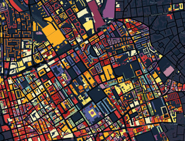
Colouring London
Colouring London aims to collect information on every building in London, to help make the city more sustainable.

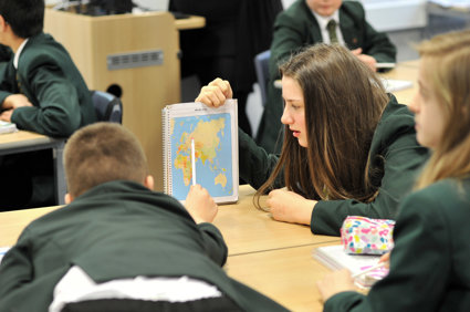
An introduction to Geographical Information Systems (GIS)
People, places and population change
ArcGIS Posters
Written by Philip Monk.
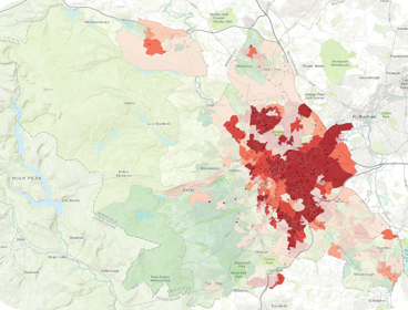
LondonMapper: exploring a World city through Census data
LondonMapper: exploring a world city through census data.

Investigating the geography of crime
Produced by Raphael Heath, Head of Geography at the Royal High School Bath, as part of an Innovative Geography Teaching Grant from the RGS-IBG.
Join as a School Member
School Members have access to a huge range of additional resources, online lectures and more

Not sure if you're a Member?
If you are a student and not sure if your school is a School Member of the Society, please email education@rgs.org with your school name and postcode. If your school is a Member we will email you a login and password to access our resources.