Hydrogeomorphological monitoring and assessment tools for rivers
Research by geographers at Queen Mary, University of London has created a set of multi-scale tools for assessing river form, function and condition that have enabled stakeholders in river catchments to know their rivers better and manage them more sustainably.
Issue
Natural processes and human actions drive the form and function of rivers from small patches of the riverbed to entire catchments across timescales from hours to centuries. Yet the majority of assessments of river condition are only based on limited habitat inventories, often recorded on a single occasion.
Approach
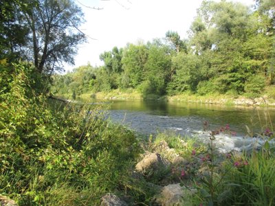
The research has demonstrated that vegetation plays a crucial role in driving river form and function by retaining and stabilising sediments.
The research team produced the multi-scale, Catchment Framework for Hydrogeomorphology, which subsequently adopted by the European Committee for Standardization (CEN). This defines the appropriate river landscape processes and properties to be analysed at different space-time scales and then synthesised to determine river-floodplain system functioning, and the degree of modification by human activities.
The research has also delivered tools to capture river morphodynamics, including PlaceMarker and MoRPh CSci, a hydrogeomorphology-habitat assessment tool designed for use by citizen scientists. MoRPh CSci has been refined for professional use (MoRPh Pro) and combined with River Type, a tool for determining the geomorphic type of river under analysis, to produce an innovative, peer-reviewed method for River Condition Assessment.
Impact
The multi-scale Hydrogeomorphological Framework has underpinned the rewriting of European Union guidance for river management under the Water Framework Directive (WFD).
PlaceMarker underpins the work of the Environment Agency’s (EA) National Environmental Assessment and Sustainability (NEAS) team. Ninety-one EA staff have been trained and the survey is being used on over 80 river stretches in England.
As of December 2020, there are 488 MoRPh CSci surveyors who have jointly undertaken and uploaded 4487 MoRPh surveys. In addition to 49 EA staff, other river professionals and numerous NGOs (e.g. Rivers Trusts: Essex, Ouse and Arun, Severn, South-East, Thames21; Wildlife Trusts: Dorset, Essex, Kennet, Norfolk, Suffolk, Trent, Wiltshire) are using MoRPh CSci to evaluate river restoration and natural flood management projects.
There are 40 EA staff with access to MoRPh Pro; 67 surveyors from 23 environmental consultancies (including Aecom, Arup, Ascerta, Atkins, Black & Veatch, cbec, FPCR, Jacobs, Mott MacDonald); and 25 surveyors from 17 Rivers Trusts who are trained in the RCA and have jointly collected 2121 MoRPh Pro surveys.
Share this resource
This is an open access article under the terms of the Creative Commons Attribution License (CC BY NC 4.0), which permits use, adaptation, distribution and reproduction in any medium or format, provided the original work is cited and it is for non-commercial purposes. Please contact us for other uses.
How to cite
Royal Geographical Society (with IBG) (2023) Hydrogeomorphological monitoring and assessment tools for rivers. Available at https://rgs.org/hydrogeomorphologicalmonitoring Last accessed on: <date>