Sefton Council uses geographic information systems to support more open data sharing
Downloads
Challenge
Sefton Council has an overarching ‘One Council’ policy where departments collaborate closely and share resources.
However, the web mapping system at Sefton Council was outdated and no longer supported by its supplier. It was difficult to manage and import new datasets, and supplying information from one department to another was time-consuming. Council data needed to be centralised in a new geographic information system that encouraged methods for open data sharing within the council and with local businesses and residents.
Solution
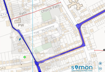
Sefton Council selected Cadcorp web mapping and standalone web service Local Knowledge, and customised these to their needs. The resulting public-facing application, named SIMON (Sefton Interactive Maps ONline), is a self-serve portal which council staff, local business and residents can access.
Sefton Interactive Maps Online from Sefton.gov.uk
Benefits
Raising awareness and better decisions
SIMON offers residents and local businesses access to a range of information from across council departments including environmental information, planning information and gritting routes, which were previously available from the council’s contact centre. Combining a wide range of data into SIMON removes the need to call individual council departments to obtain it, and enables the public and local businesses to more easily see and understand the local area and the council’s work.
Combining systems / data
SIMON makes data that council staff use on a regular basis more easily accessible and improves the way in which council data is combined. Sefton Council’s Planning and Building Control Department is responsible for a range of data-related activities, from managing data used by planning officers to producing evidence based work for the policy team.
By overlaying planning history, local plan data and policy data into a web mapping system, planning information can be shared more efficiently across council departments and directly with the public. Since the initial launch, a SIMON+ version has been added to give council staff more functionality, access to more datasets and more detail about those datasets where appropriate.
Boosting productivity and building capability
Breaking away from a silo-based environment and implementing a centralised web mapping system has allowed council departments to collaborate more closely and share consistent and standardised data. The data included in SIMON were reviewed, verified and collated to ensure confidence in their accuracy and encourage greater access to, and use of, data across the council. Address and location data from departments dealing with planning, local land charge searches, environmental protection and road adoption is now centralised and more readily available through SIMON, allowing this information to be accessed via a map-based format from a single access point, rather than manually collated from multiple departments.
Read more
Additional information about Cadcorp web mapping and the Local Knowledge web service.
Share this case study
This is an open access article under the terms of the Creative Commons Attribution License (CC BY 4.0), which permits use, distribution and reproduction in any medium, provided the original work is cited.
How to cite
Royal Geographical Society (with IBG) (2019) Sefton Council uses geographic information systems to support more open data sharing. Case study. [online] Available at: https://www.rgs.org/about-us/what-is-geography/impact-of-geography/sefton-council-uses-geographic-information-systems-to-support-more-open-data-sharing Last accessed on: <date>.