Global mangrove watch: informing public policy for the conservation and protection of mangrove forests
Aberystwyth University’s Earth Observation and Ecosystem Dynamics (EOED) Research Group has mapped mangrove extent globally, this has led to the Global Mangrove Watch (GMW) datasets.
Issue
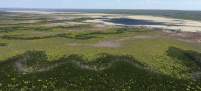
Mangroves are a highly dynamic biome which provide essential ecosystem services such as coastal protection, harvestable wood, tourism, fisheries, and carbon sequestration. However, maps depicting global changes in mangrove extent have not been available.
Approach
Global Mangrove Watch (GMW) has provided global 25m resolution maps of mangrove extent, using the Japan Aerospace Exploration Agency’s synthetic aperture radar and composite optical Landsat images. The researchers developed a new approach for detecting changes in mangrove extent.
The team also developed a new software system that automates the download and analysis of the satellite imagery. Change alerts are generated and released monthly via the Global Mangrove Watch web portal (Global Mangrove Watch).
Impact
The United Nations Environment Program (UNEP) adopted the GMW dataset as the baseline for historical mangrove extent for reporting against SDG 6.6.1. UNEP launched the SDG661 app which uses the 25 m GMW data, to represent mangrove ecosystems, providing nation states with accurate, high resolution, time-series data.
GMW datasets have supported both national governments and NGOs. For example, GMW datasets were used in Fiji to assess mangrove extent changes, ecosystem services, and to sustainably manage mangrove forests. The Government of Myanmar integrated the GMW data within their Wetland Inventory, and Madagascar National Parks has used the GMW data to aid the sustainable management of their fisheries.
Within Indonesia, the country with the largest extent of mangroves, the GMW datasets were used by various government bodies, in conjunction with the WWF to inform policy including informing management of the Marine Protected Areas (MPAs).
The Aberystwyth team also worked with Wetlands International to train their staff and local government agencies in Tanzania and Senegal to use and validate the GMW datasets.
Share this resource
This is an open access article under the terms of the Creative Commons Attribution License (CC BY NC 4.0), which permits use, adaptation, distribution and reproduction in any medium or format, provided the original work is cited and it is for non-commercial purposes. Please contact us for other uses.
How to cite
Royal Geographical Society (with IBG) (2023) Global mangrove watch: informing public policy for the conservation and protection of mangrove forests. Available at https://rgs.org/mangrovewatch Last accessed on: <date>