Vegetation analytics and management along power line corridors
Durham University research on the use of airborne high-resolution laser remote sensing technology, known as light detection and ranging (LiDAR), has underpinned the development of bespoke commercial geospatial products for electricity network operators that manage vegetation along power line corridors.
Issue
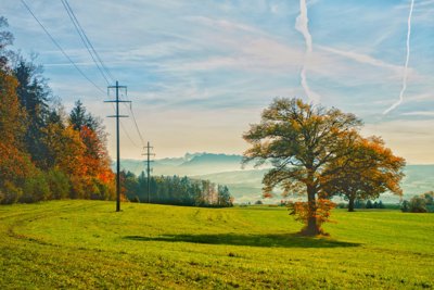
Vegetation can pose risks to electrical power lines, including growth and infringement of vegetation, causing flashover and potentially triggering wildfires. There is also risk of direct damage to the lines by falling trees or limbs.
Assessing these risks is complicated by difficulties in measuring the extent and structure of vegetation, as well as challenges in anticipated growth and seasonal change at the scale of a power line network.
Approach
Innovative use of LiDAR data identified vegetation that could cause damage to transmission and distribution lines at the whole-network scale. Durham researchers showed that airborne LiDAR intensity data could be used to distinguish between different tree species in mixed woodlands.
Further research demonstrated that statistical analysis of airborne LiDAR data could recover height and forest structural diversity in a natural forest stand. This advance makes it possible to estimate forest growth patterns and rates, and thus, anticipate infringement risks.
Impact
Collaboration with Durham University has enabled Network Mapping Group (NMG), a world-leading provider of power line engineering and utility management services, to be first-to-market with a network-scale power line risk assessment product. The risk assessment integrates multiple datasets to allow vegetation and line management, proof of compliance with clearance regulations, and assessment of risks from infringement and falling trees.
The underpinning research provides both the technical basis for the product as well as enhanced credibility with current and potential customers.
More information
Institution: Durham University
Researchers: Professor Danny Donoghue, Professor Nick Rossor, Andrew Hewitt, Sophie Davison, Dr Nick Cox, Dr Peter Watt
Share this resource
This is an open access article under the terms of the Creative Commons Attribution License (CC BY NC 4.0), which permits use, adaptation, distribution and reproduction in any medium or format, provided the original work is cited and it is for non-commercial purposes. Please contact us for other uses.
How to cite
Royal Geographical Society (with IBG) (2023) Vegetation analytics and management along power line corridors. Available at https://rgs.org/vegetationanalytics Last accessed on: <date>