Mapping the World with GIS
Explore how geospatial data and GIS are used in the real world to inform everyday tasks and systems.
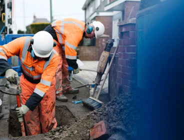
Take a closer look at the technology that maps our world and keeps it moving. Discover how GIS, drones, satellite data and digital mapping support everything from transport planning to emergency response.
Find out more about the fast-growing geospatial careers shaping the decisions we make every day through our career profiles, resources and event recordings.
This is part of our virtual work experience programme with Springpod. If you haven't completed the module yet, head to Springpod.
Meet real people working GIS and mapping
Explore our range of career profiles, spanning jobs across multiple sectors linked to geospatial data and mapping.

Owen Miller - Problem Solving Analyst, Thames Valley Police
Hear about Owen's work using data to solve crime.
Richard Martin - GIS Analyst, National Trust
Hear how Richard uses GIS to help the Natioanl Trust deliver a coordinated approach to conservation.

Patrick Rickles - Head of Business Intelligence and Spatial Data Science, HM Courts and Tribunals Service
Hear how Patrick promotes best practice in data visualisation and GIS across HM Courts and Tribunals Service.

Daniel Hall Ballester - Senior Data Specialist and GIS Manager, Marine Management Organisation
Hear how Daniel uses GIS to deliver marine planning, marine licencing and marine monitoring.

Tom Graham - GIS Consultant, Mott MacDonald
Hear how Tom's work with GIS supports construction, maintenance and operations work for major organisations.
Watch videos and listen to podcasts
Listen to our podcasts and watch online lectures featuring geographers working in the geospatial data and mapping sector.

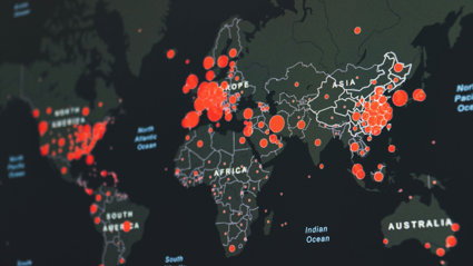
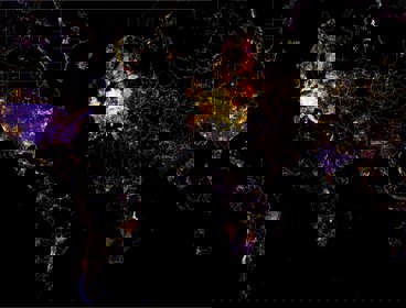
Geography in practice: WorldPop - how geospatial data puts people on the map
Combining traditional survey data with new geospatial data sources can help us to better understand the spatial distribution of people across the globe.

The United Nations and global geospatial information - James Norris
The United Nations has a role to shape and guide the geospatial information landscape and to provide geospatial data and tools for UN agencies to use.

Using GIS to survey habitats and measure improvements for Biodiversity Net Gain
Data management firm EcoSpatial Solutions has worked with the Canal & River Trust to gather baseline data and measure improvements in biodiversity net gain (BNG) accurately in England and Wales.
Remote sensing and hazard risk management with Dr Ekbal Hussain
Hear about how remote sensing is used in hazard risk management.
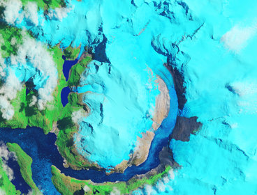
The beauty of Earth Observation in geography with Dr Fleur Visser
Hear about how Landsat, Aster and Sentinel data for Earth Observation are used.
Mapping underground Infrastructure through the National Underground Asset Register (NUAR)
Hear how NUAR is set to revolutionise the way we manage underground infrastructure in the UK and its impact upon planning and land management by giving users access to data.

Geography in practice: the foundations of a digital twin
Hear from the RGS and Ordnance Survey about the foundations of a digital twin.
Link up your learning
Use these learning materials and activities to explore how geographers working in geospatial data and mapping are linked to the geography you learn in the classroom.

Geographical careers in real estate
An introduction to the geographical career opportunities available in the real estate consultancy sector.
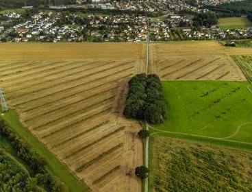
GIS in the real world - land use change
Find out how GIS is used in the real world across a range of job sectors; from environmental organisations, real estate agencies and public services.
Geovisualisations
Discover how geographers bring a unique perspective to presenting data in innovative and understandable ways.
Employers to explore
Learn about organisations working in the geospatial and mapping sector, and discover how they make a difference in the real world.
Esri is the global market leader in Geographic Information System (GIS) software, mapping, and location intelligence. Read about the real world application of their data and software. You can also find examples of how GIS is used across sectors such as Conservation, Defense, Environment, and retail.
Ordnance Survey are Great Britain's national mapping service. Find out more about the people who work at Ordnance Survey and hear how OS data and products are used in the real world. You can also see an overview of the sectors that work with OS and hear from people using OS data on their YouTube channel.
InView Assets are an example of a company that use drones to capture data, working across a range of sectors to support decision making.
Additional information about careers in geospatial mapping and GIS sector
Learn more about how Ordnance Survey use geospatial data to support emergency services.
Geo Business have a nice overview of how GIS is used across employment sectors.
Find out more about the role of a geographical information systems officer.
Find out more about the role of a geographic analyst.
Find out more about the role of a data analyst.
Find out more about the role of a geospatial Analyst.
Try other virtual work experience
Why not try some of Springpod's other free virtual work experience modules. Here are some that are relevant to our 'Mapping the World with GIS' programme module: