• Login
  • Join Us
Royal Geographical Society with IBG
  • About us
  • Geography
  • Schools
  • Professionals
  • Research
  • In the field
  • What's on

Search the Society

Enter keyword or phrase...
Find
Royal Geographical Society with IBG
Back to Resources for schools

Map skills

This six-lesson unit on map skills is designed so that one lesson will be taught in each year group from years one through six

  • Key Stage One,
  • Key Stage Two,
  • Module,
  • Fieldwork
  • Overview
  • Map skills Year One
  • Map skills Year Two
  • Map skills Year Three
  • Map skills Year Four
  • Map skills Year Five
  • Map skills Year Six

Maps have long been a source of interest and intrigue.  Early maps were largely pictorial and often inaccurate.  Over the years maps have become more and more accurate, with the use of satellite imagery.  Although maps are now widely available online, paper maps are still highly valued.  A secure understanding of maps underpins all areas of the geography curriculum.

This six-lesson unit on map skills is designed so that one lesson will be taught in each year group from years one through six.  By the end of each unit, students will have covered and developed necessary skills. The earlier lessons can be used by older pupils too, to ensure they have the baseline knowledge necessary for more advanced map reading activities. The later lessons in the sequence can also be used by younger pupils to stretch the more able.

To gain further understanding of how map skills are taught in the primary curriculum, please visit the RGS website to watch a subject knowledge animation. This animation can be used by teachers or pupils, and explains essential map skills in a visual, clear and concise way. For more information and resources on the history of maps visit the BBC website.

Map Skills Year one

This lesson begins with pupils looking at a variety of maps, including floor maps, globes and street maps.  They should be allowed to feel and touch the maps as much as possible.  
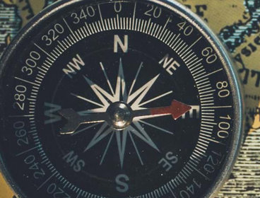
The idea of four compass points is introduced, and pupils are taught to give directions.  They then use photographs of the classroom to create their own 2-D plan of the classroom on paper.

Map Skills Year two

This lesson extends the idea of the map beyond the classroom to the whole school.  
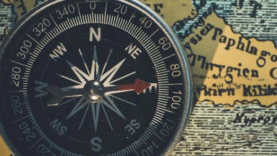
Pupils select locations to photograph within the school grounds.  They pass these photos to another group who need to find where the photos were taken and pupils use compass points to give directions to each place.  Finally, they create a map of the school grounds with the photo locations as key landmarks.

Map Skills Year three

Lesson three starts by giving pupils a sense of where the school is located within the wider world.  They use eight compass points to describe the location of capital cities within the British Isles. They learn the difference between the boundaries of Great Britain, the British Isles and the United Kingdom. Pupils develop knowledge of England, Scotland, Wales and Ireland through hands-on activities. 

Map Skills Year four

Lesson four focuses on Ordnance Survey maps and basic map reading skills.  After examining a map of the local area and discussing what they can see on it, pupils are taught to read four-figure grid references.  Pupils are also introduced to the geographical concept of scale, and map symbols. They learn why maps require the use of symbols and a map key. The lesson ends with a game of bingo using map symbols maps.

Map Skills Year five

This lesson builds on the previous lesson, but it has a greater emphasis on physical geography.  Pupils learn how hills and valleys are represented on OS maps, through the use of contour lines.  Building a 3-D model from contour lines helps to develop their understanding of how physical features are represented on 2-dimensional maps.

Map Skills Year six

The final lesson, lesson six, further develops pupils’ use of OS maps.  They learn to read six-figure grid references and practise locating the school, their house and significant buildings on a map of the local area through the use of hard-copy maps and digital maps.  They will then use their acquired skills to complete a treasure map quiz. There is also an end of unit assessment.

About the author

Following a Geography degree, Caroline Freedman trained as a secondary Geography Teacher. She has since retrained as a primary teacher but has kept her love of geography and tries to put it in its rightful place at the heart of the primary curriculum. She has run the NQT training in Enfield for the past 7 years. Caroline is a full time class teacher at The Raglan Schools in Enfield.

This resource has been developed as part of the Rediscovering London's Geography project, funded by the GLA through the London Schools Excellence Fund. It seeks to improve the quality of teaching and learning of geography in London’s schools, in addition to encouraging more pupils to study geography


Downloads

  • Map Skills Module Overview (.doc)
  • Map Skills Module Overview (.pdf)
  • Map Skills Module Plan (.doc)
  • Map Skills Module Plan (.pdf)
  • Map Skills Lesson 1 Lesson Plan (.doc)
  • Map Skills Lesson 1 Lesson Plan (.pdf)
  • Map Skills Lesson 1 Map Skills Year One (.ppt)
  • Map Skills Lesson 2 Lesson Plan (.doc)
  • Map Skills Lesson 2 Lesson Plan (.pdf)
  • Map Skills Lesson 2 The School Grounds (.ppt)
  • Map Skills Lesson 3 Lesson Plan (.doc)
  • Map Skills Lesson 3 Lesson Plan (.pdf)
  • Map Skills Lesson 3 The British Isles (.ppt)
  • Map Skills Lesson 3 Outline Map of BI (.pdf)
  • Map Skills Lesson 3 British Isles, Great Britain or UK? (.doc)
  • Map Skills Lesson 3 British Isles, Great Britain or UK? (.pdf)
  • Map Skills Lesson 4 Lesson Plan (.doc)
  • Map Skills Lesson 4 Lesson Plan (.pdf)
  • Map Skills Lesson 4 Ordnance Survey Maps (.ppt)
  • Map Skills Lesson 4 Symbols Bingo Activity (.doc)
  • Map Skills Lesson 4 Symbols Bingo Activity (.pdf)
  • Map Skills Lesson 4 Map Ability Compass Bearings (.pdf)
  • Map Skills Lesson 5 Lesson Plan (.doc)
  • Map Skills Lesson 5 Lesson Plan (.pdf)
  • Map Skills Lesson 5 Contour Lines (.ppt)
  • Map Skills Lesson 5 OS Map Symbols Flash Cards (.pdf)
  • Map Skills Lesson 5 Map Extract With Contour Lines (.doc)
  • Map Skills Lesson 5 Map Extract With Contour Lines (.pdf)
  • Map Skills Lesson 5 OS Relief and Contour Lines (.doc)
  • Map Skills Lesson 5 OS Relief and Contour Lines (.pdf)
  • Map Skills Lesson 5 Instructions 3D Model (.doc)
  • Map Skills Lesson 5 Instructions 3D Model (.pdf)
  • Map Skills Lesson 6 Lesson Plan (.doc)
  • Map Skills Lesson 6 Lesson Plan (.pdf)
  • Map Skills Lesson 6 Six-Figure-Grid-References (.ppt)
  • Map Skills Lesson 6 Treasure Hunt Resources Sheet (.doc)
  • Map Skills Lesson 6 Treasure Hunt Resources Sheet (.pdf)
  • Map Skills Lesson 6 Answers To Treasure Hunt (.doc)
  • Map Skills Lesson 6 Answers To Treasure Hunt (.pdf)
  • Map Skills Lesson 6 Digimap For School Treasure Hunt (.pdf)
  • Map Skills Lesson 6 Digimap For School Treasure Hunt Example Answers (.pdf)
  • Map Skills Lesson 6 Measuring Distance Factsheet (.doc)
  • Map Skills Lesson 6 Measuring Distance Factsheet (.pdf)
  • Map Skills Lesson 6 End of Unit Assessment (.doc)
  • Map Skills Lesson 6 End of Unit Assessment (.pdf)
  • Map Skills Lesson 6 End of Unit Assessment Answers (.doc)
  • Map Skills Lesson 6 End of Unit Assessment Answers (.pdf)
  • Download all

Login

Sign in
Forgotten password

Or continue as a guest...

By placing a booking, you are permitting us to store and use your (and any other attendees) details in order to fulfil the booking.
We will not use your details for marketing purposes without your explicit consent.

Continue

This content is restricted

You must be a member holding a valid Society membership to view the content you are trying to access. Please login to continue.


Not a member? Find out how to join

Join us today, Society membership is open to anyone with a passion for geography

Find out more

Address

Royal Geographical Society
(with the Institute of British Geographers),
1 Kensington Gore,
London, SW7 2AR

Please note that we are currently only receiving post once a week. If possible, please phone or email us instead.

Registered Charity, 208791

E enquiries@rgs.org

T +44 (0)20 7591 3000
F +44 (0)20 7591 3001

Follow us

We are the learned society for geography and geographers. Be part of our community by following us on our social media accounts.

  • twitter
  • youtube
  • linkedin
  • facebook

Links

  • JOIN THE SOCIETY
  • COURSES AND EVENTS
  • TEACHING RESOURCES
  • NEWS
    PRESS AND MEDIA
  • HIRE OUR VENUE
    MYSOCIETY LOGIN
    PRIVACY NOTICE
    SITE MAP

Cookies on the RGS website This site uses cookies to enhance your user experience.