Using geospatial data techniques to fight disease and improve population estimates
Downloads
Geographers developed GIS and survey methods to collect population data in places where census data can be outdated or incomplete, supporting large development and public health projects.
Challenge
Understanding the spatial distribution and characteristics of a population is important in targeting and planning policy interventions and humanitarian responses, as well as understanding potential impacts and repercussions at national and sub-national scales.
For example, inaccurate census data in Nigeria hampered efforts to effectively target polio vaccination campaigns. Similarly, in the Democratic Republic of the Congo (DRC) vaccination distribution is planned at a hyper-local level, but decisions have been based on outdated data or local surveys, which must then be then collated centrally.
Solution
GRID3 (Geo-Referenced Infrastructure and Demographic Data for Development) works with countries to generate, validate and use geospatial data on population, settlements, infrastructure, and boundaries. The programme provides countries with a unique package of tools with which to generate open-source data, as well as support for data applications to ensure effective impact, and training to strengthen the national geospatial foundation for future evidence-based development and humanitarian decision making.
The programme also provides support to countries in census modernisation, primarily through digital mapping, satellite imagery, and increased use of geospatial information systems (GIS) to improve accuracy, timeliness, quality, and use of census data.
This can include geospatial analyses of census data to identify populations in need, for countries conducting a census where enumerators cannot be deployed to certain areas due to inaccessibility, disasters, or insecurity, GRID3 can support modelling processes to estimate populations that otherwise would go uncounted. Population estimates are created by combining data derived from a ‘microcensus’ (a set of complete population counts collected within small areas that are sampled from across a country) with machine-learning analyses of satellite imagery and available maps of boundaries, settlements and key points of interest (such as road networks and water infrastructure).
GRID3 builds on previous work done by other programmes around modelled population estimates for census under-coverage in Afghanistan and polio eradication efforts in Nigeria.
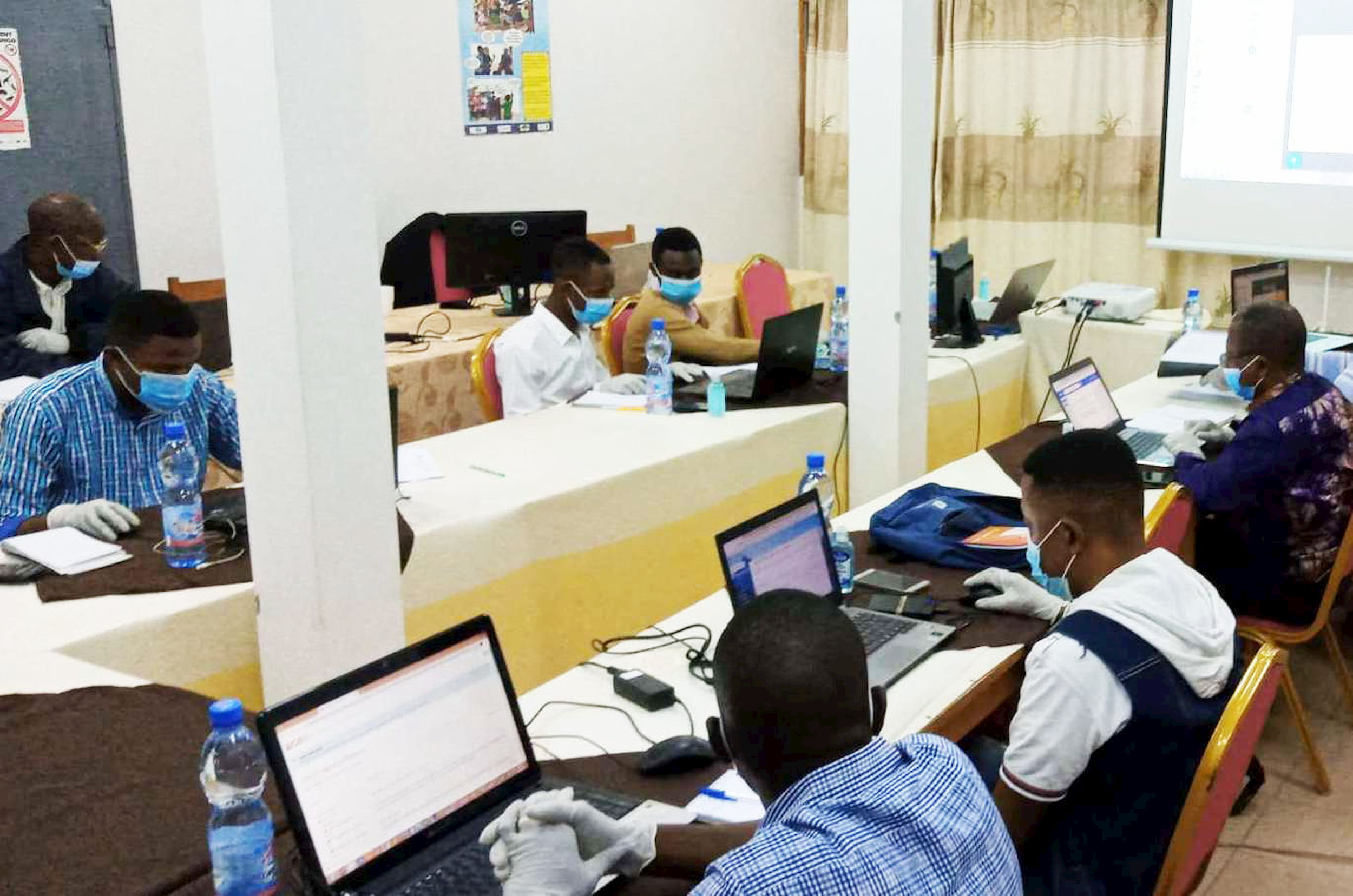
Participants from the Trainer Support Programme at the University of Kinshasa, Democratic Republic of the Congo
Benefits
Better decision-making and governance
The GRID3 programme is supporting the delivery of the Sustainable Development Goals – in particular, improving public health outcomes by helping plan vaccination programmes. In the DRC, GRID3 trained health workers in geolocation skills so that they could produce data on the geography of health facilities and settlements which were then combined with sample surveys and machine learning trained on demographic data.
GRID3 supported the ‘micro-planning’ process that Nigeria’s National Primary Health Care Development Agency used to accurately and collaboratively map settlements for vaccination programmes, contributing to the effective elimination of wild polio in Nigeria in 2019.
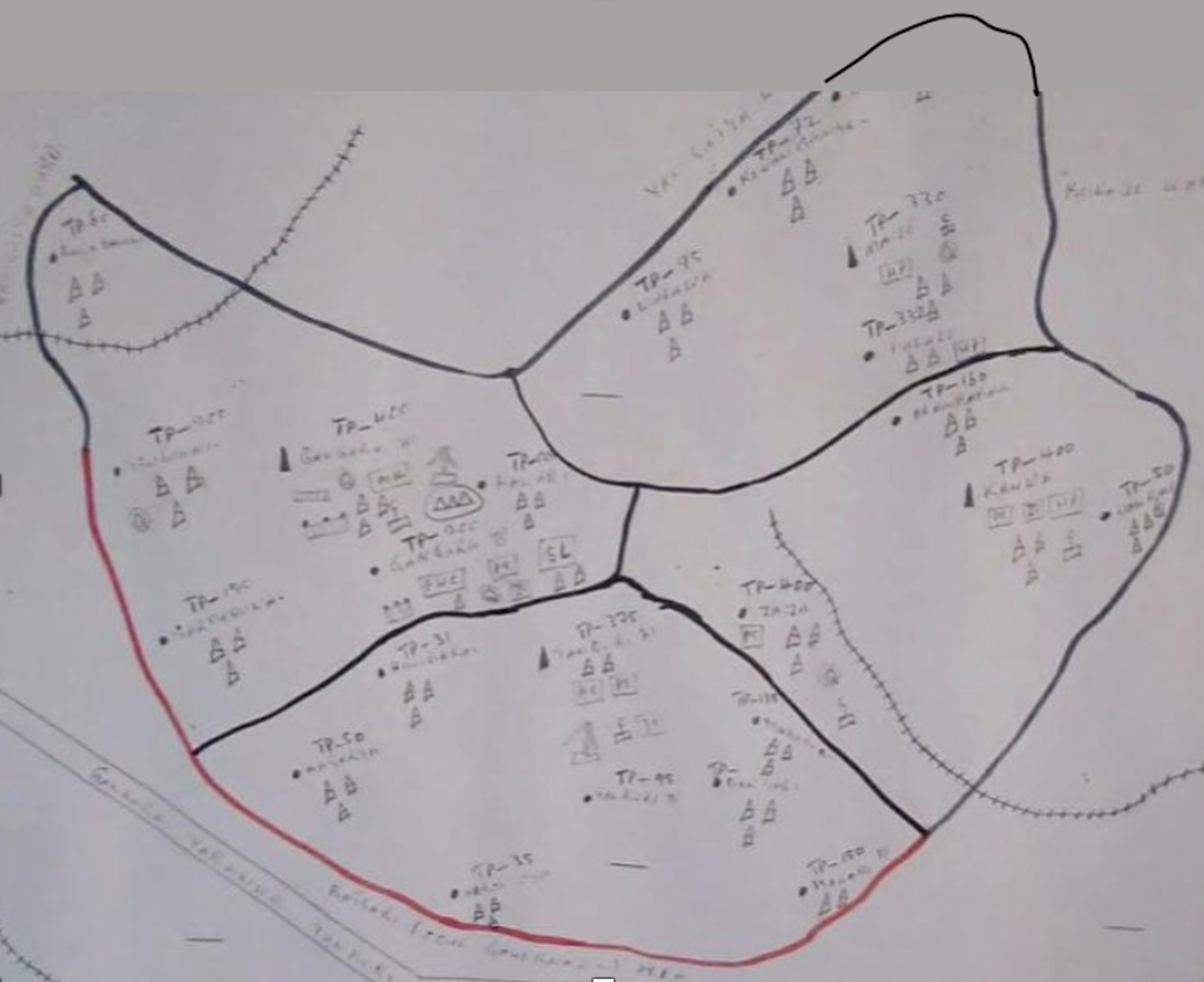
Gangara Ward, Jibia Local Government Area, Katsina State - hand-drawn settlement map
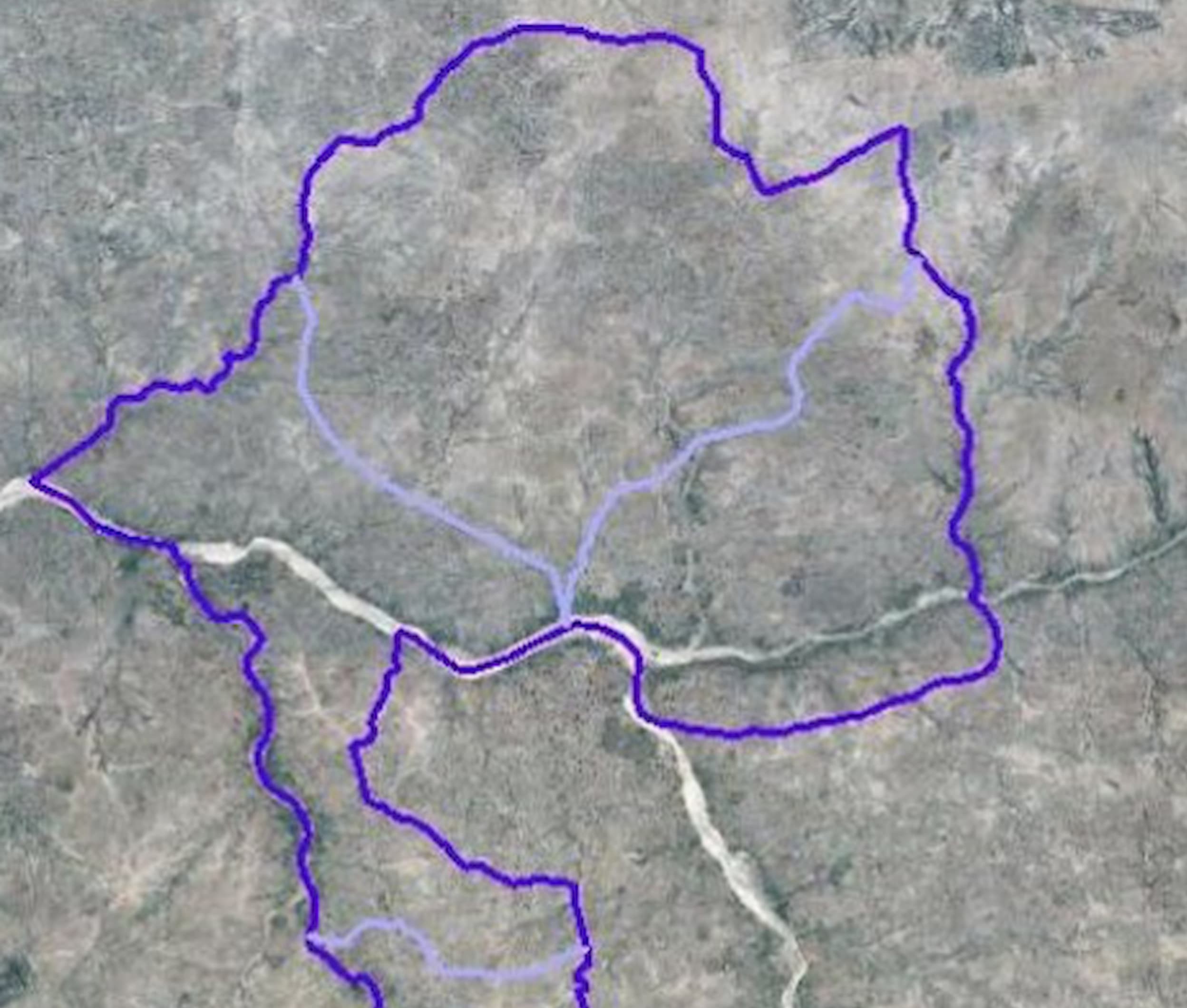
Gangara Ward, Jibia Local Government Area, Katsina State - improved digital map
Combining systems or data
Access to geodata is a key programme aim of GRID3 in Nigeria, where a geodatabase containing data on boundaries, settlements, and over 500,000 points of interest collected in the project was made publicly available.
In Zambia, GRID3 provided high-resolution data for enumeration area demarcation that supported the government’s pre-census cartography exercise. GRID3 is currently working closely with Zambia’s National Spatial Data infrastructure to build data awareness and strengthen capacity around geospatial data use.
GRID3 data are available at grid3.org, and some population data are visualised on the WorldPop interactive WoprVision web map (which also enables population estimation for user-defined areas and API access). Specific programme strands also share data, such as via the GRID3 Nigeria data portal.
Building capability and boosting productivity
Alongside data collection, processing, and analysis, the GRID3 programme also offers technical support and capacity strengthening. For example, participants from Nigeria’s National Bureau of Statistics and National Population Commission are being trained for the pilot of Nigeria’s first national gridded population survey.
The GRID3 team has supported national geospatial capacity in six countries to aid their responses to COVID-19. For example, working with the Zambian National Spatial Data Infrastructure Technical Committee, GRID3 has integrated data and mapping on COVID-19 hotspots, populations, and healthcare facilities into a platform for the Zambian government to access and use the data.
GRID3 has also launched an online Learning Management System to enable the remote training of data experts in Nigeria and the DRC, using competency-based distance learning.
.jpg?ext=.jpg)
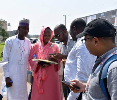
Representatives from Nigerian government and non-government agencies in the field, using skills learnt from workshops on gridded population survey sampling methodology.
Further reading
-
Visit the GRID3 website
-
Follow the GRID3 team on Twitter @grid3global
-
Access data on the GRID3 Nigeria data portal
-
The woprVision data viewer by GRID3 partner WorldPop, which overlays population data on maps and facilitates population estimates
Share this resource
This is an open access article under the terms of the Creative Commons Attribution License (CC BY NC 4.0), which permits use, adaptation, distribution and reproduction in any medium or format, provided the original work is cited and it is for non-commercial purposes. Please contact us for other uses.
How to cite
Royal Geographical Society (with IBG) (2020). GRID3: Using geospatial data techniques to fight disease and improve population estimates. Available at www.rgs.org/impact/grid3. Last accessed on: <date>