Spatial Hub: Turning local government data into self-sustaining assets
Downloads
Accessible and good-quality geospatial data can help local government organisations to better deliver services. The Improvement Services's Spatial Hub acts as a unified platform for sharing geospatial data between organisations in Scotland, while also improving and standardising datasets.
Challenge
Data collected by local government is often only collected for specific business purposes, with few standards applied and with little attention to its value as an asset for use elsewhere within local government or wider commercial benefit.
Local government data collection and standardisation is useful for assessing, monitoring and comparing the impacts of policy interventions, connecting different policy areas and data interoperability. Addressing challenges of interoperability and data quality at a national level through good, well-resourced data management could underpin a digital transformation in the use of local government data.
Solution
The Improvement Service, a local government-owned company providing good-practice support and resources for local government in Scotland, runs a number of initiatives around digital delivery of public services. One of these is increasing the accessibility and usability of local government-created data through the Spatial Hub, delivered by the Spatial Information Service which is now part of a wider Data and Intelligence team at the IS.
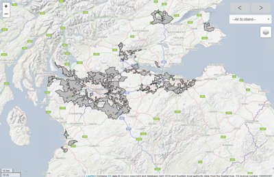
Spatial Hub provides a single point of access to standardised and quality-controlled Scottish local authority data. The Hub is cloud-hosted, built on a mostly open-source tech stack and brings together different themes of data from each of the 32 local authorities in Scotland.
Launched in 2016, there have been over 1600 uploads from councils, national parks and archaeology services, and several million uses of Spatial Hub datasets. There are now 44 datasets available via the Spatial Hub (4 open, 1 only available to local government and the rest available to all public and academic organisations). These are continuously collected, improved and published from the Spatial Hub. The most popular include school catchments, planning applications and tree preservation orders. The Spatial Hub now also publishes data from other sectors as negotiated and required i.e., health sector data and utility company’s data.
Benefits
Combining systems or data
The data are currently made available to all public bodies in Scotland in line with the Public Sector Geospatial Mapping Agreement (which superseded the One Scotland Mapping Agreement), enabling data teams to access quality-controlled data from across the country for their own uses.
Datasets are also available to the commercial sector to pay for data access - Spatial Hub has been approached by over 200 private companies for access to Spatial Hub data – and to the academic sector via EDINA’s Digimap service.
Over 100 organisations have been issued with Spatial Hub authentication keys and are actively accessing datasets for their business. More than 150 other academic and commercial organisations have also requested data access. Several organisations, including SEPA and Marine Scotland, are using bespoke web services to stream Spatial Hub datasets directly into their online web mapping applications.
The Hub can enable better integration and improvement of local authorities’ own work with geospatial data, simply by making it more accessible. Because the Hub is compliant with the EU’s INSPIRE directive, it also offers an easy route for local authorities to meet their INSPIRE obligations by uploading their data for processing and publication. Local authorities can also connect some their own pre-existing web services.
The Spatial Hub’s use of open-source technology for hosting and standardising data helps reduce maintenance costs.
Boosting productivity and improving capability
Agreements with each council permit the Improvement Service to act on their behalf to implement a data quality improvement programme and facilitate user access to Council datasets. Datasets were incrementally prioritised, collected and published over the past three years. The Hub also has agreements in place with two national parks and 32 local authorities to represent their interests around data sharing and improvements,
The Spatial Hub reduces the work needed for external organisations to access the data by offering easy and quick access to data in ShapeFiles and GeoJSON formats, as well as web services, enabling easy use with mapping software.
Without specific central government funding, the Improvement Service argues that the most sustainable business model is to generate revenue from commercial usage of the datasets, and that collating, improving and publishing data widely via a single source or project is a cost-effective approach.
Commercialisation of local government-created data saw £250,000 reimbursed from Ordnance Survey sales of address data in 2019, which was returned to local authorities to spend specifically on certain areas of data improvement. The Hub is now seeking to enable greater data availability by obtaining further funding. These commercial data sales can help raise the profile and perceived value of local government data collection and sharing, and the Spatial Hub intends to extend this commercialisation model to a wider range of datasets.
Further reading
-
Find more details on the structure of the hub
-
Read a blog about the Hub by Head of the Spatial Information Service
Share this case study
This is an open access article under the terms of the Creative Commons Attribution License (CC BY NC 4.0), which permits use, adaptation, distribution and reproduction in any medium or format, provided the original work is cited and it is for non-commercial purposes. Please contact us for other uses.
How to cite
Royal Geographical Society (with IBG), Association for Geographic Information (2019). Spatial Hub: Turning local government data into self-sustaining assets. Case study. [online] Available at: www.rgs.org/spatialhub Last accessed on: <date>