Using remote sensing and experimental innovation to understand, monitor and forecast wildfires
Downloads
Geographical research has identified and improved our understanding of the scale of wildfires around the world. Using satellite-based remote sensing techniques and on-the-ground monitoring, researchers have identified wildfire mitigation strategies, provided air quality forecasts and drawn attention to the significance of wildfires for climate change.
Challenges
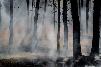
The characteristics of wildfires can differ depending on location, climate and fuel source. Their ephemeral nature can also make the global scale and impacts of wildfires difficult to quantify and understand. A better understanding of wildfires can help design interventions to prevent and mitigate the impacts of fires on land management, air quality, and greenhouse gas emissions.
Solution
Geographers have created influential measures, tools and experimental techniques to advance research into wildfires. Professor Martin Wooster (King’s College London) combined satellite observations of infrared emissions with measurements of the energy emitted by masses of burning vegetation, and created an algorithm to quantify the fire radiative power (FRP). He then experimentally measured FRP to work out the relationships between fuel consumption and smoke emission. Applying data on emissions from geostationary satellites enabled Professor Wooster to develop live monitoring and quantification of fire size and characteristics around the world.
Dr Thomas Smith (LSE) and Dr Jake Simpson, working alongside Professor Wooster, further developed remote sensing and experimental techniques to refine understandings of burn characteristics, particularly in tropical peatlands. This included using airborne mapping techniques (LIDAR) to examine surface topographies under forest canopies (and so more accurately quantify material burnt in fires on rich forest and peatland soils); and spectroscopy of peat smoke to understand the characteristics of emissions from burning peat.
Benefits
Solving problems
The work has revolutionised fire research techniques, directly informing European Commission monitoring programmes and the design of new satellite missions and equipment. This has included the implementation of the Global Fire Assimilation System (GFAS) in the MACC and subsequent Copernicus Atmosphere Monitoring Service (CAMS) projects. These use FRP models and observations to estimate wildfire emissions and scale; GFAS has been used worldwide to deliver forecasting and real-time monitoring of fires and emissions and air quality.
Better decisions
Dr Smith’s work on fire growth modelling was included in the National Fire Chief’s Council Fire Prevention Toolkit, helping inform best practice and fire prevention strategies in the UK.
Dr Smith and Professor Wooster also contributed to the FIREfficient project from 2014-2015, which drew together researchers from a number of European governments and institutions to develop tools for wildfire risk reduction.
This yielded a number of activities and tools and the Lessons on Fire knowledge exchange for practitioners in land management and fire services, with Dr Smith’s contributions including:
-
Knowledge exchange workshops with fire services and land managers in the UK,
-
Training materials and an integrated approach for risk assessment and land management.
-
A new protocol for testing fire spread models
-
For wildfire risk reduction
Results from Dr Smith’s work in tropical peatlands, in collaboration with Dr Stephanie Evers (Liverpool John Moores) was recently cited in the Roundtable for Sustainable Palm Oil’s Best Management Practices for Oil Palm Cultivation on Peat, informing better land management decisions to reduce greenhouse gas emissions from tropical peatland agriculture.
Boosting productivity and building capability
Professor Wooster’s research was incorporated into Meteosat satellites to provide novel remote sensing methods for assessing radiative power (PDF), and the data made available free in real-time from the EUMETSAT Land Satellite Applications Facility.
In 2019, King’s College London and Imperial College London were awarded £10m to establish a joint Wildfire Research Centre to focus collaborative geographical and interdisciplinary research on wildfires in four key areas – the urban interface, the North, the tropics, and global systems.
Dr Smith’s work on UK fires will contribute to a new £2m project on developing the components for a UK Fire Danger Rating System, while his research in tropical peatlands continues through a £3.4m international collaboration to improve the sustainable development of peatlands in Indonesian Borneo.
Further reading
- Dr Smith’s guest post on CarbonBrief about wildfires and climate change
- Read more about the FireEfficient project
- The blog of the UK Tropical Peatland Working Group includes a post on tropical peatland fires by Smith
- The Copernicus atmosphere & LANDSAF projects, which both apply the research
- Wildfire Research Centre
- School teaching resources on the 2019/20 Australian wildfires (KS3, 4 and 5)
Share this resource
This is an open access article under the terms of the Creative Commons Attribution License (CC BY NC 4.0), which permits use, adaptation, distribution and reproduction in any medium or format, provided the original work is cited and it is for non-commercial purposes. Please contact us for other uses.
How to cite
Royal Geographical Society (with IBG) (2020). Using remote sensing and experimental innovation to understand, monitor and forecast wildfires. Available at https://www.rgs.org/about-us/what-is-geography/impact-of-geography/using-remote-sensing-and-experimental-innovation-to-understand-monitor-and-forecast-wildfires. Last accessed on: <date>.